Connected map

At AISIN Mobility, we are touching the future by extending the vision of automated vehicles. We are enabling automakers to create their own HD map and ADAS content, for improved safety and reduced costs.
Most vehicles are already equipped with cameras and sensors and have a minimum level of connectivity. However, in order to support Level 2 automated driving features and beyond, many vehicles still have deficiencies.
Indeed, it remains a challenge to ensure that the data is precise, complete and communicated rapidly enough to ensure safety and comfort for vehicle users.
Creating HD map & ADAS content
This is why high-definition, or HD maps are needed. This is the latest generation of highly-detailed maps, offering sufficient completeness and precision of content to enable vehicles to visualize for themselves what is on the road!
Additional road and infrastructure characteristics need to be provided; for example:
Static: road condition, potholes, road signs
Dynamic: slippery roads, real-time traffic, obstacles, ghost drivers or other hazards
Where temporary or live data is concerned, speed of communication is also critical.
Data monetisation
At Aisin Mobility, we assist our car manufacturer and mobility customers in generating their own, proprietary data, thus reducing costs associated with having to purchase full HD maps.
Additional content can also be generated on the vehicle’s surroundings.
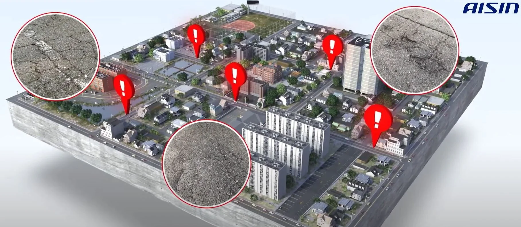
Aisin’s smart road maintenance support
One example is Aisin’s collaboration with Okazaki city in Japan to generate data on the presence and location of potholes, thus saving time and money:
Automated detection of pot-holes using in-vehicle edge computing unit
Precise location of pot-holes logged on a map to assist with maintenance workers’ planning
Contact us to find out more about Aisin’s smart road maintenance support or other data monetisation solutions.

Why trust us?
Aisin’s location-based services technology
Aisin works with car manufacturers to capture data in real-time and send it to the cloud where it is processed using our proprietary algorithms. Several data sources can be cross-referenced and fused to ensure accuracy. Data can then be added to update existing maps or, alternatively, sent directly back to vehicles, providing live information to drivers for their safety and comfort.
We use our proprietary lane-level precise positioning and map-matching, along with our electronic horizon module, to ensure accurate and immediate data communication.
Aisin’s experience
At Aisin Mobility, navigation and positioning is in our DNA. We launched the world’s first navigation with audio guidance with Toyota / Lexus in 1992. We were also the first to launch hybrid navigation technology. We have developed proprietary map-matching technology with lane-level precision to enable autonomous driving, with or without GPS signals and maps.
Global reach
We have a track record of delivering and maintaining navigation and positioning systems in the global market place, accounting for regional technical and legal complexities such as forthcoming European safety legislation.